Tuesday, December 27, 2011
Mount Oread OCTA-Trails & Tales
http://www

Labels: eco-challenge, eco-history, KU GIS Day, OCTA-Trails Marker, Planet U, watershed


Tuesday, September 06, 2011
MSHS Fur Trading Post by rjburkhart at Garmin Connect
The Rivers, Trails, and Conservation Assistance Program
is the community assistance arm of the National Park Service.
RTCA supports community-led
natural resource conservation and outdoor recreation projects.
RTCA staff provide technical assistance to communities
so they can conserve rivers, preserve open space, and develop trails and greenways.
Labels: agritourism, eco-history, MentorshipART, Planet U, social responsibility, watershed
Saturday, December 11, 2010
Wakarusa Watershed memetics researcher


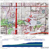 |
| Clear Creek Watershed Impact Zones |
Labels: distributed learning, eco-challenge, eco-history, geotourism, national heritage trail, Planet U, social geocoding, social responsibility, watershed
Monday, October 25, 2010
Grand Tetons NP GeoVenturing

Tuesday, June 22, 2010
Blanton's Crossing Eco-History Mystery

Kanza-Chapter_OCTA-Trails_Eco-History-Mystery_X529xm.gpx (NatGeoMaps Topo4.exe mapXchange)
Labels: agritourism, eco-history, MentorshipART, OCTA-Trails Marker, social responsibility, watershed
Friday, October 23, 2009
Fifth Freedom Eagle with Attitude :: Thinking Indian
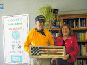
Over the years the environment and human interaction significantly affected the inherited traits of individuals. I believe thinking Indian is not just a philosophical approach, it is a cognitive process. If American Indian people ever stop “thinking Indian,” we will become cognitively extinct.
There has been significant research related to Indian students and learning modalities, styles and specialized pedagogy, but it is often juxtaposed with Western theories of learning and cognitive processing. The tribal colleges have intrinsically become centers of “Indian thinking” and need to continue their practices and research to improve American Indian
student outcomes.
Richard B. Williams is the president and CEO of the American Indian College Fund, the nation’s largest provider of private scholarships for American Indian students seeking to better their lives and communities through a college education at the nation’s 33 accredited tribal colleges and universities.
Labels: distributed learning, eco-history, national heritage trail, outdoor recreation, Planet U, social responsibility, watershed
Friday, August 21, 2009
OCTA-Trails GeoVenturing-LNTreks

During our 2009 Oregon-California Trails Association (OCTA) Conference in Loveland, CO (Kanza Territory), we experienced the world premiere of a unique "learn and share" wagon train documentary about western migration via today's Wyoming into Oregon.
Crafting NCLI ARTifacts for adaptive outdoor recreation "Eco-Challenges"
Empower consequential learning for "Know Your Wilderness Inquiry Zones" (WIZ)
[A] Reflects actionable distilled insights (WIZdom) for "EarthSea-Keeping" group activities
[B] Builds on FutureThought Leadership experiences with blended "Visual Learning" hyperportals
[C] Creates sharable community stewardship stories about "geoWIZard" MentorshipART ...
Labels: distributed learning, eco-history, national heritage trail, outdoor recreation, social responsibility, watershed
Saturday, May 23, 2009
FIFTH Freedom's natural heritage adVenturing (FFnha)
Labels: “Blog Action Day”, distributed learning, eco-challenge, eco-history, geotourism, national heritage trail, OCTA-Trails Marker, outdoor recreation, Planet U, social responsibility, watershed
Tuesday, March 31, 2009
What NOW? Healthy US ... Happy Earth


Kaw Valley Heritage Alliance (KVHA) champions public health risk management practices supporting effective Kaw and Wakarusa Valley water quality assurance programs.
State-wide KELP virtual team tactics empower these ALL-WinWin attributes:
[1] EarthSea Keeping Attitudes
[2] Sustainable Land-Use Aptitudes
[3] Pragmatic Problem-Solving Ability
[4] Management by Results Accountability
The Upper Wakarusa WRAPS* is several things. On paper, it is a plan for prolonging the usability of Clinton Lake for water supply. ... kawvalleyheritagealliance.org/wraps/
As a FFNHA Partner, KVHA intends to reinvest our social capital (knowledge, skills and abilities) to advocate FIFTH Freedom sustainable well-being (LIFE. Liberty and the pursuit of happiness).
Labels: “Blog Action Day”, agritourism, distributed learning, eco-challenge, eco-history, national heritage trail, outdoor recreation, social responsibility, watershed
Monday, March 16, 2009
Podstock-PlanetU InterDependence

Forty years after executing my FOCCPAC-Kunia permanent change of station (PCS) orders from USS Cimarron in San Diego (via Washington Navy Yard), I’m helping INFLUENCE adoption of “Reusable Learning Objects” via Kan-Ed Network’s empowered (ALL-WinWin Education Futures) Web 2.0 hyperportals …
Early 1969 experiences as an extra during filming “Tora! Tora! Tora!” at Pearl Harbor inspired my seeking ROOT causes of GlobalBrain inter-regional warfare!
My persistent Kanzana research found that cartographer Josiah Gregg’s 1844 Map of the Indian Territory catalyzed “Manifest Destiny” mindshifting (aka “extractive economics” myths) that still drive and influence non-sustainable (anti-ethical) public policy via flawed Group Decision Support System (GDSS) frameworks!
Digitized Kansas Map Collection
Title: A map of the Indian Territory, Northern Texas and New Mexico showing the Great Western Prairies Content Date: 1844. Author: Gregg, Josiah ...specialcollections.wichita.edu/collections/maps/detailsframes.asp?offset=-1&var=1844-0002 - Cached More results from specialcollections.wichita.edu »
MentorshipART mapXchange(cc) / LostLegends
Spellbinding Stories Empowering ALL-WinWin ... Education Futures ... Section 3: Group Dynamics. January 14, 2009: Group Dynamics by Petty and Caccioppo ...minnesotafuturist.pbwiki.com/LostLegends
Labels: agritourism, distributed learning, eco-history, national heritage trail, Planet U, social responsibility, watershed
Friday, February 20, 2009
WakarUSA Watershed Eco-History of Lost Gold
Results: lost kansas gold wakarusa.
Search Results
Gold Prospecting, Treasure Hunting, Mining, Relic Hunting, and ...
Treasure of an Army paymaster was lost near Lawrence, Douglas County. ... Prospecting: Handbook to the Gold Fields of Nebraska & Kansas ...www.treasurefish.com/kansas%20treasure%20hunting.htm -
Labels: agritourism, eco-history, national heritage trail, outdoor recreation, watershed
Sunday, January 25, 2009
FIFTH Freedom natural history adVenturing (FFnha)

became the 200th posting since Pathfinder Passports began.
Crafting No Child Left Inside ARTifacts for adaptive outdoor recreation "Eco-Challenges"
Empower consequential learning for "Know Your Wilderness Inquiry Zones" (WIZ)
Our 2009 Podstock Festival Trails-n-Tails" (TnT) theme:
[A] Reflects actionable distilled insights (WIZdom) for "EarthSea-Keeping" group activities
[B] Builds on FutureThought Leadership experiences with blended "Visual Learning" hyperportals
[C] Creates sharable community stewardship stories
about "geoWIZard" MentorshipART ... Rev: 25-Jan-2008
Att-1: NAIS-2006 Education Futures Flat World HotTopics PPT
Att-2: Minnesota Futurist Steve Troutman's Virtual Team PPT Slides
Att-3: WorldFutures 2007-07 The Future of Teams Panel PPT Slides
Labels: “Blog Action Day”, distributed learning, eco-challenge, eco-history, geotourism, leapfrog, outdoor recreation, Planet U, social responsibility, watershed
Monday, December 08, 2008
Teaching the Civil War with Technology

Labels: distributed learning, eco-history, Planet U, social responsibility
Monday, November 10, 2008
geoWIZard3 Eco-Region Profile
North America
I | INTRODUCTION |
North America, third largest of the seven continents, including Canada (the 2nd largest country in area in the world), the United States (3rd largest), and Mexico (14th largest). The continent also includes Greenland, the largest island, as well as the small French overseas department of Saint-Pierre and Miquelon and the British dependency of Bermuda (both made up of small islands in the Atlantic Ocean). With 524 million inhabitants (2007 estimate), North America is the 4th most populous continent; the United States ranks 3rd and Mexico 11th in population among the world's countries. Canada and the United States have technologically developed early modern economies, and Mexico, although less technologically developed than its neighbors, contains some of the world's greatest deposits of petroleum and natural gas.
Together with Central America, the West Indies, and South America, North America makes up the Western Hemisphere of Earth. North America is sometimes defined to include Central America and the West Indies, which are treated separately in Encarta Encyclopedia. The name America is derived from that of Italian navigator Amerigo Vespucci, who may have visited the mainland of North America in 1497 and 1498.
III | THE PEOPLE |
North America was sparsely populated until relatively recent times. With the conspicuous exception of the inhabitants of the Mexican heartland (the plateaus and valleys around present-day Mexico City), the indigenous peoples of the continent were geographically scattered and culturally diverse. The settlement of the continent by Europeans began an almost total change in its human geography; Europeans decimated and displaced the indigenous peoples, and the living patterns of most were greatly altered. The contemporary population of North America is mostly European in background, but the continent's population also contains many other important groups.
A | Ethnography |
At least 35 percent of Canada's inhabitants trace their ancestry to the British Isles, and another 25 percent are of French background; the latter live mostly in Québec Province. The country also has significant numbers of people of German, Italian, Polish, Ukrainian, Chinese, Dutch, and Scandinavian descent. The population of the United States is more diverse than Canada's. In 1990, people of at least part British or part Irish background formed the largest group, with approximately 29 percent of the country's inhabitants.
Blacks, who trace their ancestry to Africa, make up 12 percent of the population, Germans 23 percent, and people of Hispanic background 9 percent. The country also has large numbers of people of Italian, Polish, French, Russian, Dutch, and Scandinavian ancestry. Persons of Asian origin—primarily Japanese, Chinese, Filipinos, Asian Indians, Koreans, and Vietnamese—make up only 2.9 percent of the population of the United States, but since the 1970s the number of Asians increased significantly through immigration.
Indigenous peoples, including Inuit and Eskimo, number 1.9 million in the United States and 800,000 in Canada. It is believed that the ancestors of the Native Americans migrated from northeastern Asia to North America via a prehistoric land bridge across the modern Bering Strait, off Alaska, that existed from about 25,000 to nearly 10,000 years ago. The forebears of the Inuit migrated from Asia by boat some 6,000 years ago. Some 30,000 Inuit live in Greenland.
Some 60 percent of the people of Mexico are mestizos, persons of mixed Native American and European (mainly Spanish) descent. Approximately 30 percent of the population is of relatively pure Native American ancestry, and some 10 percent is of unmixed European descent.
B | Demography |
In 2007 the United States had 301,139,950 inhabitants; Mexico 108,700,890; Canada 33,390,141; and Greenland 56,344. Most of the population was concentrated in the eastern half of the United States and adjacent parts of Ontario and Québec, the U.S. Pacific coast, and the central plateau of Mexico. In the late 1990s more than 76 percent of the inhabitants of Canada, the United States, and Greenland were defined as urban, as were 74 percent of all Mexicans. The principal urban areas were on the U.S. Atlantic coast from Boston to Washington, D.C., around the shores of Lakes Erie and Ontario, at the southern end of Lake Michigan, in northern and southern California, and greater Mexico City.
The largest cities included Mexico City, Guadalajara, and Monterrey, in Mexico; New York City, Los Angeles, Chicago, Houston, Philadelphia, and San Diego, in the United States; and Toronto, Montréal, Vancouver, Ottawa, and Edmonton, in Canada. Away from the metropolitan areas, most of North America had only a sparse to moderate population density. In Mexico the overall population density was 56.5 persons per sq km (146.3 per sq mi); in the United States, 32.9 per sq km (85.2 per sq mi); and in Canada, 3.7 per sq km (9.6 per sq mi). The great majority of Canadians lived in a relatively narrow band along the southern boundary.
In both Canada and the United States the rate of population increase has declined since the 1950s. The Canadian population increased by about 1 percent per year from 1980 to 1990, when the annual growth rate for the United States was also 1 percent and for Greenland, 1.2 percent. Mexico, however, had one of the hemisphere's highest rates of population increase, 2.2 percent per year, and its birth rate (20.4 per 1,000 people in 2007) was about double that of the rest of the continent. The death rate was 5 per 1,000 people in Mexico, 8 in Canada, and 8 in the United States
Intercontinental migration to North America was significant in the 1980s and 1990s, with large numbers of Asians and Europeans going to the United States and Canada. In addition, many people moved from South American and Caribbean countries to the United States. The largest population movements, however, occurred within North America itself, from Mexico to the United States and from the northeastern United States to southern and western parts of the country.
C | Languages |
English is the principal language for some 90 percent of the people of the United States and for about two-thirds of all Canadians. Spanish is spoken by the majority of Hispanic people in the United States, and French is the chief tongue for about one-quarter of the Canadian population. Many of the indigenous peoples and Inuit of the United States, Canada, and Greenland use their traditional languages. Spanish is the dominant language of Mexico, but several million Mexicans speak a Native American language.
D | Religion |
Christianity is the major religion of North America. The great majority of Mexicans are Roman Catholics, and some 45 percent of Canadians and 26 percent of U.S. inhabitants profess Roman Catholicism. Some 28 percent of Canada's people are Protestants and 8 percent are Anglicans. In the United States, Protestants make up 58 percent of the population. Canada and the United States also have substantial communities of Jews and Eastern Orthodox Christians.
E | Cultural Activity |
Cultural life in the United States and Canada is highly developed and diversified, with the mass media (radio, television, motion pictures, and newspapers) playing an important role. Almost all North American cities support theatrical organizations and art museums, and musical groups are widespread. Traditional cultural patterns are more evident in the rural areas of Mexico, but its cities have a variety of modern cultural institutions.
F | Hemispheric Developments |
A second important development in the history of the continent in the 19th and especially in the 20th century was the participation of the North American nations in the movement manifest throughout the Western Hemisphere for economic cooperation, for the attainment of peace and mutual understanding, and for solidarity against potential aggressors. In this movement the United States played a leading part, starting in 1823 with the Monroe Doctrine—the proclamation of President James Monroe that the United States would not permit European control of territories in the Americas beyond that existing at the time.
The only serious intracontinental conflict was the so-called Mexican War (1846-1848) between the United States and Mexico. During the 20th century a tendency toward mutual friendship developed among the nations of the Western Hemisphere, given form in 1910 with the establishment of the Pan-American Union. Almost all the nations of the Western Hemisphere either declared war on or broke diplomatic relations with the Central Powers in World War I (1914-1918) and with the Axis Powers in World War II (1939-1945).
One of the most important demonstrations of hemispheric solidarity was the Inter-American Defense Conference of 1947, which promulgated the Inter-American Treaty of Reciprocal Assistance—the Rio Treaty—which was signed by the United States, Mexico, and 17 Central and South American nations. The treaty provides for settlement of disagreements between nations of the Western Hemisphere, as well as for joint defense against aggression on the region extending from the Bering Sea to the South Pole. In 1948 the Organization of American States (OAS) was formed to implement the Rio Treaty and to serve as a collective security system.
Hemispheric cooperation was temporarily furthered by the Alliance for Progress, which was established in 1961. The alliance, which was accepted by the United States and 19 Latin American nations at Punta del Este, Uruguay, consisted of a ten-year development plan to raise the economic and social levels of the area and to strengthen its democratic institutions. After the original ten-year period, however, the alliance showed mixed results, and it gradually ceased to function.
The existence after 1959 of a Communist government in Cuba tended to complicate hemispheric activities. In 1962, at Punta del Este, the OAS voted to exclude Cuba from participation in the Inter-American system because of that nation's alignment with the countries of the Communist bloc.
The relations between the United States and Canada have been particularly friendly and cooperative since the War of 1812. No military installations aimed at defense against each other have existed since that time on the entire border between the two nations. The United States and Canada collaborated closely in the fight against the Axis Powers during World War II. In the postwar period, usually referred to as the era of the Cold War, the Canadian and American governments initiated plans for joint defense against possible aggression from the Soviet Union across the Arctic regions.
Mexico's serious internal strife from 1910 to 1920 and its nationalization of U.S. oil companies in 1938 plagued relations between the two nations during the first half of the 20th century. More recently, however, their relationship has been more friendly, as evidenced by the signing of the North American Free Trade Agreement (NAFTA), which encouraged trade among the United States, Mexico, and Canada.
Microsoft ® Encarta ® 2008. © 1993-2007 Microsoft Corporation. All rights reserved.
Labels: eco-history, geotourism, KU GIS Day, outdoor recreation, watershed
Monday, June 16, 2008
Kaw Valley Lenape Legends

NationMaster - Encyclopedia: Turner, Kansas
In 1828, Cyprian Chouteau established the first trading post in this locale.
... The Delaware Crossing (or "Military Crossing"; sometimes "the Secondine")
...www.nationmaster.com/encyclopedia/Turner,-Kansas - Cached - Similar pages
NationMaster - Encyclopedia: Grinter Place
By the 1820s, François Gesseau Chouteau's family, part of the American Fur Company,
... Beginning in the 1830s, the Delaware tribe, the Wyandot tribe,
...www.nationmaster.com/encyclopedia/Grinter-Place
Labels: agritourism, eco-history, national heritage trail, outdoor recreation, social responsibility, watershed
Tuesday, June 10, 2008
Ninemile Creek ... Lost Legends of La Flecha

[PDF]
TRANSPORTATION DECISIONMAKING
FHWA periodically reviews quality issues and adjusts its programs and processes to ensure ...
Route "NINEMILELVFT": 5114.35 mi.
TOPO! GPS Route,NINEMILELVFT
NINEMILEHC,44.89786,-93.43558,906,06/07/2008,08:08:45,
NINEMILEMN,44.80053,-93.29022,695,06/07/2008,08:08:45,
NINEMILERN,41.24721,-94.27080,1169,06/07/2008,08:08:46,
NINEMILELV,39.25304,-94.88724,780,06/07/2008,08:08:45,
NINEMILEMO,39.26278,-94.87664,799,06/07/2008,08:08:45,
NINEMILEKS,39.00667,-95.02942,810,06/07/2008,08:08:45,
NINEMILEKV,39.17658,-95.20306,1091,06/07/2008,08:08:45,
NINEMILEC1,36.59976,-97.87228,1090,06/07/2008,08:08:45,
NINEMILENP,48.27964,-92.86478,1197,06/07/2008,08:08:45,
NINEMILEVP,48.28919,-92.85189,1238,06/07/2008,08:08:46,
NINEMILEBW,47.57558,-91.08344,1616,06/07/2008,08:08:44,
NINEMILENS,47.50491,-91.11459,1403,06/07/2008,08:08:46,
NINEMILEWI,45.89246,-89.13791,1674,06/07/2008,08:08:46,
NINEMILEID,47.47409,-115.92544,3176,06/07/2008,08:08:45,
NINEMILEWA,48.97045,-119.42645,1691,06/07/2008,08:08:46,
NINEMILEOR,43.98956,-122.38811,2820,06/07/2008,08:08:46,
NINEMILECA,40.04599,-121.63720,2934,06/07/2008,08:08:45,
NINEMILEAZ,32.23508,-109.47118,5224,06/07/2008,08:08:44,
NINEMILENM,36.43059,-105.29056,8333,06/07/2008,08:08:45,
NM9MILECRK,36.44943,-105.34017,9167,06/07/2008,08:08:46,
by way of the Cimarron River (called La Flecha -- the arrow -- in 1719) ...
- Cached - Similar pages
Labels: agritourism, eco-history, Planet U, social responsibility, watershed
Saturday, April 12, 2008
Nat Geo Mag Guardian of a Ghost World:

Unforgiving Land
The Fremont culture arose before A.D. 400 in the hardscrabble region that is now most of Utah and parts of nearby states. Despite the dry, unforgiving climate, they managed to cultivate corn, beans, and squash along waterways like Range Creek and the river from which they get their name.
-----------------
From the narrative above, I was able to find end-points for a transect between river confluences & generate an elevation profile ...
Fremont River to Range Creek Confluence, 28.63°TN, 71.16 miles
TOPO! GPS Data Format Deg NAD83 ElevFeet
FREMONTRVR,,38.40248,-110.69293,NA,FREMONT RIVER ... DIRTY DEVIL (UTAH BR_4)
RANGECREEK,39.30747,-110.05708,NA,04/12/2008,16:57:14,RANGE CREEK CONFLUENCE
Labels: distributed learning, eco-history, geotourism, social geocoding, social responsibility, watershed
Sunday, March 23, 2008
Kansas Birding Hot Spots

Labels: “Blog Action Day”, agritourism, eco-challenge, eco-history, national heritage trail, outdoor recreation, social responsibility, watershed
Saturday, January 12, 2008
KSHS-KVHA GeoVenturing-LNTours(cc)

Kanza-OCTA Trails-n-Tales(cc)
Click title above for StoryTech Demo or here for Picasa2 pix ...
Uniontown Ferry Crossing: River Roots Research
Seeking inter-regional benchmarks for All-WinWin Eco-Futures: "TRCP.org" usda natural resource preservation protection fws.gov wetland habitat recreation trails
Labels: “Blog Action Day”, agritourism, eco-history, geotourism, national heritage trail, OCTA-Trails Marker, watershed
Wednesday, October 03, 2007
SFTA Social Responsibility Pathfinders (7o03am)

Historic Arkansas Riverwalk of Pueblo \ HARP Foundation Tax Credit ...
A curriculum guide based on the Zebulon Montgomery Pike expedition's
exploration of the American west is available for use in the classroom areas
...www.puebloharp.com/boetcher.htm - Cached - Similar pages
Zebulon Pike's Discovery of the Peak Commemorative Activities & Events
Call for the teachers curriculum guide, poster and materials to distribute which commemorate Pikes
http://www.puebloharp.com/ ...www.santafetrailscenicandhistoricbyway.org/pike.html - Cached - Similar pages

Historic Arkansas Riverwalk
http://puebloharp.com/
Historic Arkansas Riverwalk, Colorado's newest vacation attraction in Pueblo Colorado. River Boat Rides for families and special events on the Arkansas River in Colorado.Colorado/Front-Range-Region/Pueblo-County/Pueblo/Travel/Attractions
Santa Fe Trail New Mexico National Scenic Byway Information Page
... Nancy Robertson, Treasurer;
PO Box 1516; Raton, NM 87740; (505)445-8226
...www.santafetrailnm.org/bywayinfo.html - Cached - Similar pages
Labels: “Blog Action Day”, distributed learning, eco-history, national heritage trail, outdoor recreation, social responsibility, watershed


