Sunday, April 23, 2006
Tom Parker :: dispatches from kansas (6423pm)
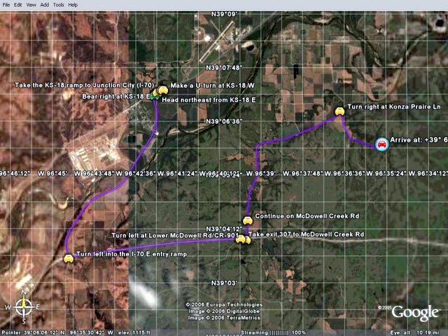
View from the Top ... birthplace of Kings Creek
TOPO! GPS Data Format Deg NAD27 ElevFeet
TOPO! GPS Route,KONZAPRAIRIE
KONZARIVER,39.11528,-94.60917,722,KANSAS RIVER (KAW POINT)
KINGSCREEK,39.11972,-96.61472,1050,KINGS CREEK :: KVHA-STREAMLINK PATHFINDER PASSPORT
CONFLUENCE,39.10139,-96.59194,1105,KINGS CREEK BRANCHES
SBRKINGSCK,39.09107,-96.58596,1162,SOUTH BRANCH KINGS CREEK
SBRKNG1213,39.08779,-96.57721,1213,14:35:26,
SBRKNG1224,39.08437,-96.58332,1224,14:36:47,
KONZAPRAIR,39.09306,-96.55833,1372,KONZA PRAIRIE NATURAL AREA
NBRKINGSCK,39.08789,-96.55598,1403,NORTH BRANCH KINGS CREEK
Experience http://Virtual-Team-Tactics.futurethought.info
Labels: distributed learning, eco-challenge, geotourism, social geocoding, social responsibility, watershed
![]()
![]()
