Thursday, June 30, 2011
GeoVenturing RO/CS (River Orienteering / Community Stewardship) @ http://bit.ly/khOM0i
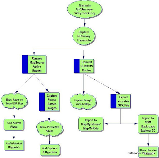
Garmin GPSurvey-Waymarking:
Capture GPSurvey Traceroute
Rename MapSource Active Routes
Show Route on Topo-USA Map
Find Nearest Places
Add Historical Waypoints
Capture Picasa Screen Images
Share PicasaWeb Album
Add Captions & Hyperlinks
Convert to RO/CS Routes:
Export sharable GPX File
Import to MapMyFitness/MapMyRide
Import to NGM Backroads Explorer 3D
Show Elevation Profiles
Capture Google Maps Collage
![]()
![]()
