Saturday, July 30, 2005
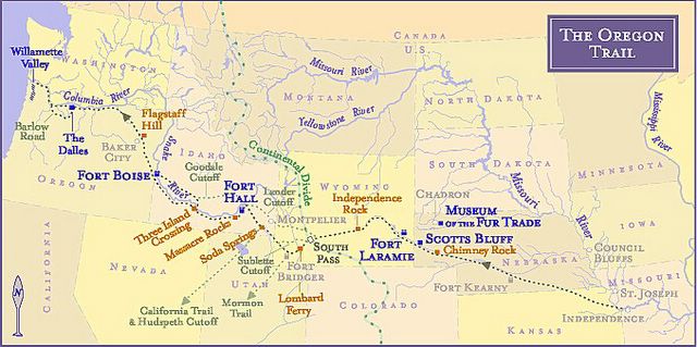
MAP: Exploring Fur Trade Routes of North America
Research team tutors at the Shawnee, Kansas
Johnson County History Museum (913) 631-6709
suggested contacting Oregon-California Trails Association
@ http://www.octa-trails.org/Preservation/Legislation/
EcoTrekUSA-i4C mapXchange
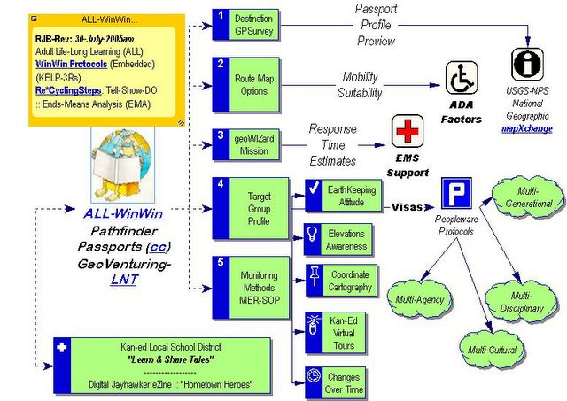
Kudos to Tim Anderson with Barr Engineering
for quick-response "GeoScouting" GIS-Tips!
See :: Glenn's GISuser Weblog
Tim created this awesome high-resolution HyperPort overview!
The resolution of this v-Learning graphic matches floor map installed
for Twin Cities MN River Basin at USNPS Visitor's Center in lobby of
the Science Museum of Minnesota (SMM)
However, each of the watershed waypoint "targets" we plotted
are "worst-case" locations for HazMat "spill drill" scenarios!
See other EcoTrekUSA-MapXchange ... URLs
EcoTrekUSA-i4C mapXchange
Re*Visioning (Whats Ahead?)
as Visual Learning Actionable Distilled Insights
inspired by former Kansas Governor (1908-1912)
... Walter Roscoe Stubbs via KSHS.org
EcoTrekUSA-i4C mapXchange
Walter Roscoe Stubbs :: KSHS-i4CQuest
After him came the misnamed redheaded governor. He was not a redhead,
he was flaxen polled, but he acted like a redhead most of the time,
Walter Roscoe Stubbs.
Just about that time along came the Bull Moose movement, led by the immortal Teddy Roosevelt, and this division in the Republican party resulted in the defeat of Stubbs for the U. S. senate.
Kansas State Historical Society, A Moment in Time, suffragists
...Governor Walter Roscoe Stubbs had urged support for woman suffrage
in his inaugural speech and was a member of the men's auxiliary ...
@ www.kshs.org/features/feat397.htm - Cached - Similar pages
Governors - Kansas State Historical Society
Walter Roscoe Stubbs, 11 Jan 1909 - 13 Jan 1913, none
... Walter Roscoe Stubbs Born 7 Nov 1858, Richmond, Va.,
and died 25 Mar 1929, Topeka
www.kshs.org/genealogists/individuals/officials/governors.htm
- Cached ... [ More results from www.kshs.org ]
Wednesday, July 27, 2005
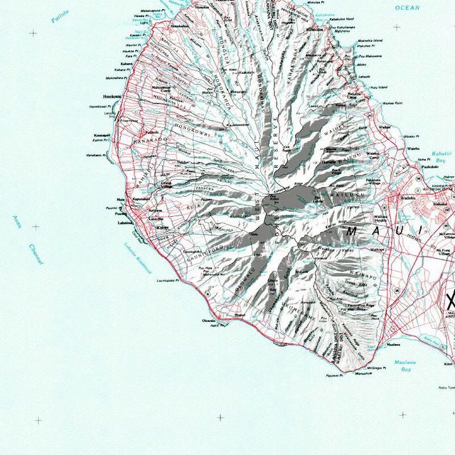
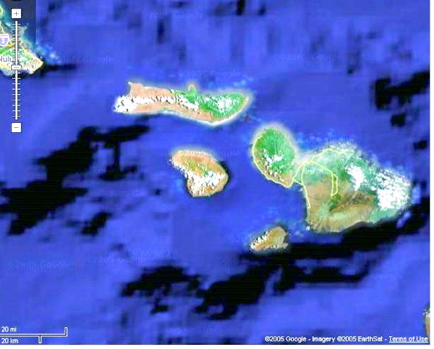
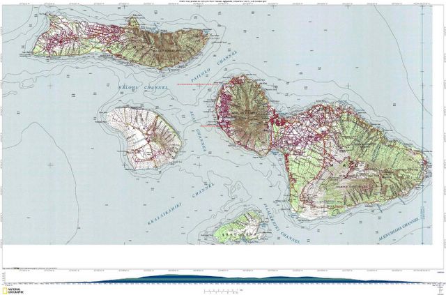
Location: Lat 20.8693, Lon -156.615
State: Hawaii
Topo Map Source: Maui 2 of 3
Source Scale: 1:100000
Map Source Year: 1975
PLSS Township: T, R
EcoTrekUSA-i4C mapXchange
WOW!! Just finished reading a captivating fiction book
by Christopher Moore ... FLUKE (ISBN:0-06-056668-X)
Note: It distills FutureThought Leadership insights
from ongoing work of the Whale Trust / 300 Paani Place / Paia, HI 96779
>>So still was the great beast that he might have been floating in deep space, the last beacon of some long dead space-traveling race - except that he was making croaky noises that would have sounded more appropriate coming out of a two-inch long tree frog than the archaic remnant of a super race.<< isbn="0-06-056668-X"
EcoTrekUSA-i4C mapXchange
TOPO! GPS Data Format Deg NAD83 ElevFeet
LAHAINA,20.87026,-156.67882,3,WEST MAUI PORT OF LAHAINA, HAWAII-USA
EcoTrekUSA-i4C mapXchange
![]()
![]()
